Gifting has never been easier
Perfect if you're short on time or are unable to deliver your gift yourself. Enter your message and select when to send it.

| Product: | BDR |
|---|---|
| Works With: | All Vehicles |
| Manufacturer: | Backcountry Discovery |

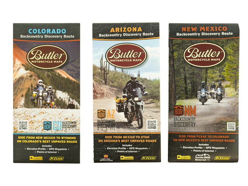
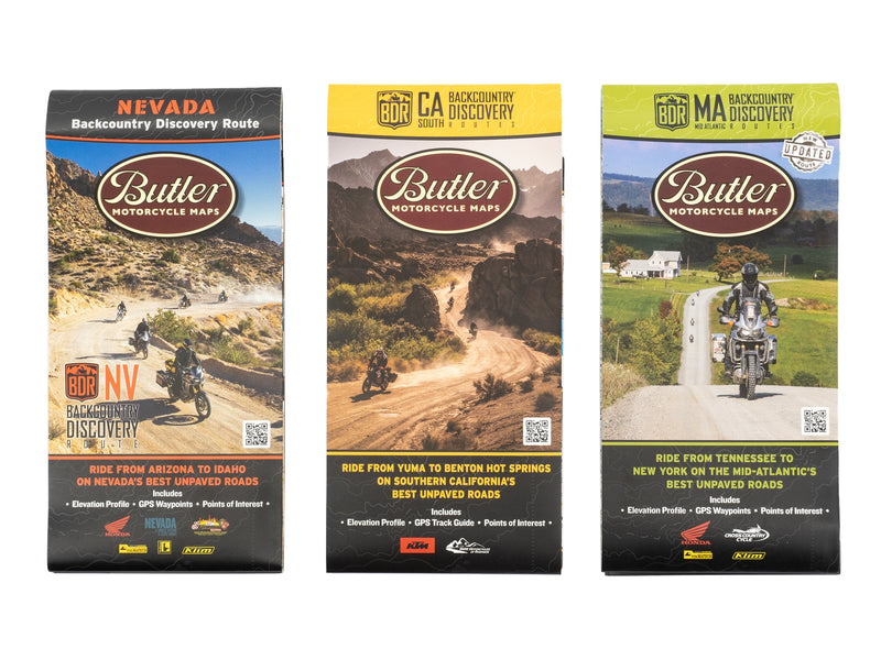
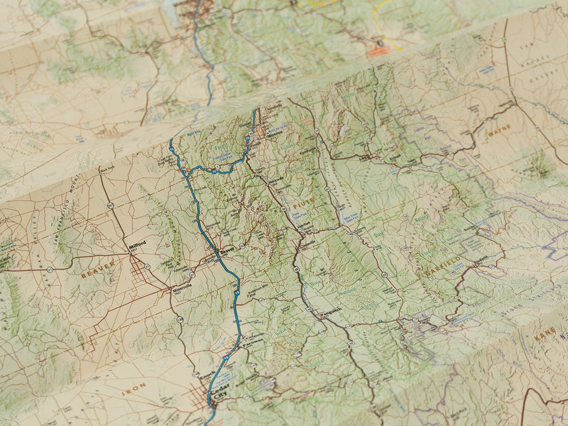
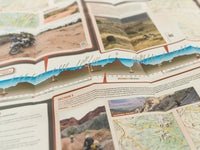
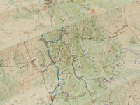
Originally designed for off-road adventure motorcycle riders, Backcountry Discovery Maps have been embraced by the four-wheeling community as excellent route planning guides. These route maps will open up a whole new world of off-pavement adventure, and are jam packed with just about everything you'll need to know. Turn to the back of the map for detailed inset boxes, written descriptions, elevation profiles, points of interest, photos, and a whole bunch of useful information to help plan your journey.
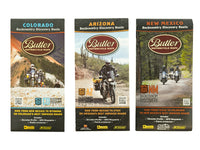
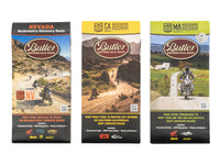
Explore routes through: Arizona, California, Colorado, Nevada, New Mexico and Utah.
Product specs:
• Made of waterproof and tear-resistant material
• Folds to a convenient 4.25" x 9" size
Arizona: Ride from the Mexico border to the Utah border on Arizona's best unpaved roads with the Arizona Backcountry Discovery Route map from Butler Motorcycle Maps. This two-sided, fully synthetic map is waterproof and tear resistant - perfect for use in the backcountry, and will help you plan your next motorcycle adventure in Arizona with its route map, elevation profile, GPS waypoints, and other valuable planning information for the AZBDR. This map is a planning tool to help you prepare to ride the Arizona Backcountry Discovery Route. Make sure to bring detailed forest maps and a GPS unit with the route tracks to navigate the route. This planning map does not have the detail required to be a primary navigation tool.
The AZBDR is a scenic ride across the state of Arizona, beginning at the Mexico border and finishing at the Utah border. The route has been created specifically for dual-sport and adventure motorcyclists who are interested in exploring Arizona’s remote back-country. This 750-mile south-to-north route utilizes many remote dirt roads and leads riders through iconic locations including the Mogollon Rim, Sunset Crater National Monument, Grand Canyon, and the Navajo Nation.
California: The CABDR-South is the ninth route created for dual-sport and adventure motorcycle travel and the first wintertime BDR. This spectacular, yet challenging, 820-mile ride across the Southeastern region of California, starts in Yuma, AZ, and ends in Benton, CA. Primarily using rugged two-track and remote dirt roads the route leads riders through majestic canyons, rocky riverbeds, and sandy washes of California’s famous deserts and national preserves. You’ll experience quirky desert enclaves and ghost towns, visit historic mines, see ancient petroglyphs and intaglios, dip in healing mineral hot springs and ride among the unique Joshua trees in the Mojave National Preserve.
Colorado: Ride from New Mexico to Wyoming on Colorado's best unpaved roads with the Colorado Backcountry Discovery Route map from Butler Motorcycle Maps. This two-sided, fully synthetic map is waterproof and tear-resistant - perfect for use in the backcountry, and will help you plan your next adventure in Colorado with its route map, elevation profile, GPS waypoints, and other valuable planning information. This map is a planning tool to help you prepare to ride the Colorado Backcountry Discovery Route. Make sure to bring detailed forest maps and a GPS unit with the route tracks to navigate the route. This planning map does not have the detail required to be a primary navigation tool
The Colorado Backcountry Discovery Route, COBDR, is a multi-day off-road adventure that sends dual-sport motorcycle riders through the most dramatic and rugged landscapes in Colorado. The route begins at the Four Corners National Monument in southern Colorado and ends 675 miles away at the Colorado-Wyoming border. This route utilizes a variety of unpaved roads with rocks, mud, sand, and water crossings to make it fun and challenging.
Nevada: Throw your preconceptions of Nevada out the window, it’s so much more than what you’ve seen from I-15 or the Vegas Strip. Ride the NVBDR 908 miles across the state and you’ll understand why Nevada is an adventure rider’s dream. This is not the hardest route in the BDR lineup, but it is one of the most unique and adventurous, bringing you through incredibly desolate landscapes while connecting one-of-a-kind communities brimming with lively locals eager to tell you their stories.
New Mexico: We are excited about this route as it presents riders with a true “Backcountry” experience with little interaction with the public, and showcases the beauty of New Mexico’s diverse and distinctive landscapes. Experience challenging riding on remote backcountry roads covering 1,200 miles through the beautiful state of New Mexico. You’ll encounter scenic terrain including high-elevation forests, mountains, deserts and canyons, as well as the unique culture and history of New Mexico’s rural towns, native reservations, historic locations & more.
Utah: Ride from Arizona to Idaho on Utah's best unpaved roads on the Utah Backcountry Discovery Route (UTBDR) using this high-quality synthetic map from Butler Motorcycle Maps. The UTBDR is a mostly off-road route stretching from Southern Utah to the Idaho border. The South to North route winds through remote deserts, dense pine forests, and dramatic canyons. The roads include dirt, gravel, and pavement surfaces, and may include rocks, sand, mud, and snow depending on the time of year and conditions. There are several alternate sections of the route that include more difficult terrain as well as options that become passable earlier in the season. The route is designed from South to North and is much easier in that direction. This map is a planning tool to help you prepare to ride the Utah Backcountry Discovery Route. Make sure to bring detailed forest maps and a GPS unit with the route tracks to navigate the route. This planning map does not have the detail required to be a primary navigation tool.
The front of the map features the entire state of Utah with major roads, and the highlighted UTBDR route with beginning and endpoints. Each segment of the route is blown up into a detailed view on the back of the map. The backside also features valuable information on fuel stops, food, lodging, weather info, and points of interest along the way. Bar-codes throughout the map can be scanned with a smart phone to play videos of the route.